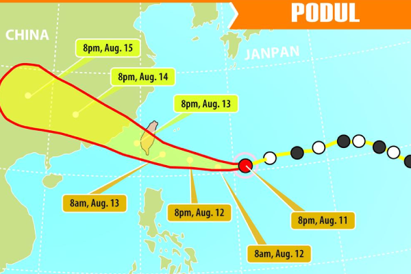
Typhoon Podul will make landfall near Taitung Wednesday around midday, then move through southern Taiwan before entering the Taiwan Strait in the late afternoon or evening, according to the country’s Central Weather Administration (CWA)
The CWA issued a warning of similar circumstances in the afternoon for locations south of Chiayi County, noting that higher winds and heavier rain were already occurring Wednesday morning in Hualien and Taitung counties in eastern Taiwan and the Hengchun Peninsula in the southernmost portion of the island.
The weather agency said, Podul, the 11th typhoon of the season, has gotten a little stronger. Its center is over waters east-southeast of Taitung, and it is moving west-northwest.
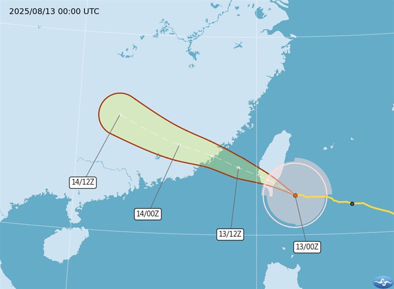
The storm’s radius reached land in Hualien and Taitung and the Hengchun Peninsula by 6 a.m., the CWA said, and as of 10 a.m., its eye was located 90 kilometers southeast of Taitung, and moving west-northwest at 32 kilometers per hour, according to CWA data.
Read Also
It was carrying maximum sustained winds near its center of 155 kph, with gusts of up to 191 kph.
The storm will be at its peak during the day Wednesday, with eastern Taiwan, Chiayi and areas to the south, and the Penghu Islands seeing the most significant effects, including heavy rain or localized torrential rain, according to the CWA.
Hualien, Taitung, and southern highland areas are likely to see exceptionally heavy rain (24-hour accumulated rainfall greater than 200 millimeters or 3-hour accumulated rainfall greater than 100 millimeters) or higher.
High temperatures of 27-30 degrees Celsius are anticipated for Chiayi and places to its south and east in Taiwan, while locations between Miaoli County and Changhua County should have highs of 36 degrees, and the rest of the island could see highs of 32-33 degrees, according to the CWA.
The CWA reported gusts of 150 kph in sections of Taitung (including Green and Orchid islands), with even heavier gusts forecast later that day.