Hurricane Erin, which is churning north in the Atlantic hundreds of miles offshore, is predicted to cause severe storm surge and tropical storm conditions in North Carolina’s Outer Banks and other sections of the US East Coast.
With waves as high as 6 metres coming onshore, the National Hurricane Center warned that roads on the low-lying barrier islands could become unusable.
According to the report, the strong surf is predicted to cause substantial beach erosion.
Local media reported that ferries took more than 2,220 people off Ocracoke, with the final sailing scheduled for 11am on Wednesday.
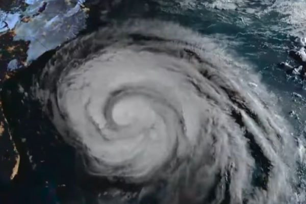
The eye of Erin, rated as a Category 2 storm with sustained winds of 155km/h, was expected to move midway between the US East Coast and Bermuda on Wednesday and Thursday as it travelled northward, the NHC said. That trajectory will keep the worst of its winds offshore.
Tropical-storm-force winds extend up to 426km from the storm’s centre, with hurricane-force winds extending for 145km.
Even so, the National Hurricane Center warned beachgoers along most of the East Coast to stay out of the water because of “life-threatening surf and rip currents”.
Swimming and other water activities were restricted on beaches in New Jersey from Cape May to Sandy Hook, with strong surf and rip current advisories in effect until Friday, according to the National Weather Service.
Coastal flooding is likely to peak at high tide on Thursday.
New York City Mayor Eric Adams has ordered that all city public beaches, including Coney Island and Brighton Beach, close on Wednesday and Thursday.
Erin, the fifth named storm of the 2025 Atlantic season and the first to reach hurricane status, had intensified into a Category 5 storm.
Hurricane Milton, which hit in October 2024, was the last Atlantic hurricane to achieve that intensity.